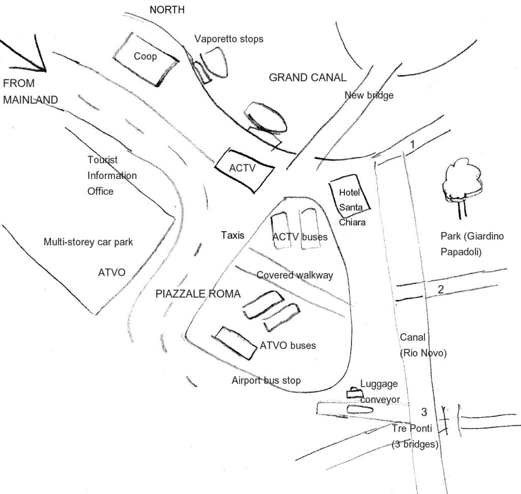
On this simplified plan we’ve labelled useful landmarks at Piazzale Roma, including the bus stops and ticket kiosks described in our detailed account.
If you are continuing your journey on foot, there are three main pedestrian exits from Piazzale Roma, which we’ve labelled 1, 2 and 3. You will need a map for onwards route-planning, though, as Venetian routes are very confusing.
Route 1 heads along the Grand Canal towards the Scalzi Bridge (Ponte degli Scalzi), which crosses to the railway station.
Route 2 heads into the Santa Croce and San Polo districts, and on towards the Rialto, although this is quite a walk and we wouldn’t recommend it with a suitcase.
At the point labelled 3, there are several interlinking bridges; it’s all a bit confusing but with a map you can set off south into the western part of Dorsoduro, and the Zattere, or head south-east across Dorsoduro to the lower curve of the Grand Canal.
Don’t set off walking with suitcases unless you have good directions from your hotel and are very sure of the way. Don’t forget you must lift your case over many bridges. Taking a vaporetto (ferry) is usually easier.
The luggage conveyor in the bottom right-hand corner is an interesting thing to watch, especially if you’re with children: porters load suitcases on and off boats here, using a sloping conveyor belt. If you want to hop straight in a gondola, there is a gondola jetty on the Rio Novo.
On this site
Useful external links