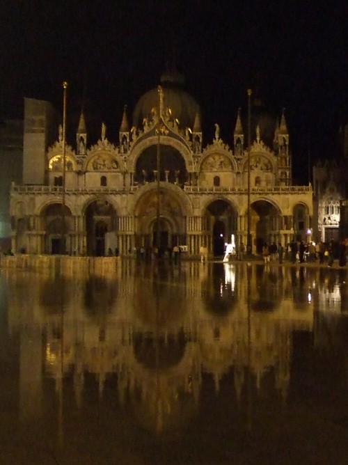
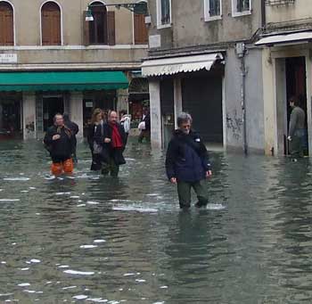
Acqua alta or ‘high water’ in Venice is a famous phenomenon; the subject of all those atmospheric photographs of the flooded city. It’s a novelty for the visitor, an inconvenience for the locals, and an indicator of the threats faced by this fragile city. Occasionally it can cause serious damage.
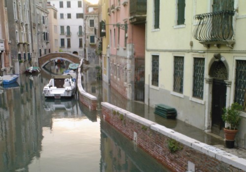
Acqua alta is an unusually high tide, which rises enough to flood parts of Venice. This flooding is most dramatic when a higher-than-average tide coincides with various other phenomena – such as heavy rainfall inland from the Venetian lagoon, a wind blowing in from the Adriatic sea or an area of low pressure.
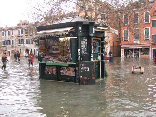
High water is most likely to occur between September and April, though it’s not unheard of at other times. It’s not as dramatic as thrill-seeking tourists may hope: the tide rises, water laps over low canalsides and rises up through the rainwater drains to cover low-lying paths and squares. Usually this minor flooding is short-lived and will subside with the tide after an hour or so. If you are planning ahead, you can expect the highest tides around the time of a full moon or a new moon.
> High water 1st December 2008 (156cm) – my eyewitness account of when the flooding reached the highest level, at that point, for 20 years. Worryingly, since then tides of this height or higher are becoming more frequent.
Predicting high water
Acqua alta is predicted and monitored, and forecasts are published each day on the council’s Centro Maree (Tide Centre) website (see links panel on the right), in local newspapers, and on electronic displays around town (one is located at Piazzale Roma). Predictions based on lunar tides are available months in advance, so you can get an idea of whether acqua alta is possible during your holiday. But short-term factors such as atmospheric pressure, wind and rainfall make a big difference and at times of exceptionally high tides the forecasts may be updated several times daily.
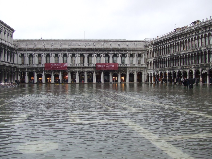
The information listing provides the twice-daily times of high tide (massimo) and low tide (minimo), along with the predicted height of water above or below a set measurement point of zero. Contrary to the impression given by some foreign news outlets, a tide of 100cm doesn’t mean that water will be a metre above the pavements. In relation to the tide measurements, most of Venice’s pavements are around 80 to 100cm in height. +85cm is a fairly high tide, and will see some water rising up through drains into St. Mark’s Square, the lowest part of town – enough for photo-opportunities but not enough to cause much inconvenience. +110cm is fairly high, and water will invade nearly 12% of Venice. When this level is predicted, sirens will sound a warning 3-4 hours in advance of high tide, warning residents to batten down the hatches and to don their wellies.
Warning sirens
Until 2007 Venice still used sirens dating to the Second World War to warn its residents of floods. Now the historic sirens have been replaced by a more modern system. When the tide is predicted to reach +110cm a recording of the old-style sirens will still be sounded to warn of acqua alta. But this will be followed by another signal, a series of electronic notes which will alert Venetians to the level of flooding expected: the more tones sounded the higher the water, from one tone predicting 110cm to four rising notes indicating serious flooding of 140cm. The speakers are concealed inside belltowers and public buildings.
Getting around Venice in the floods
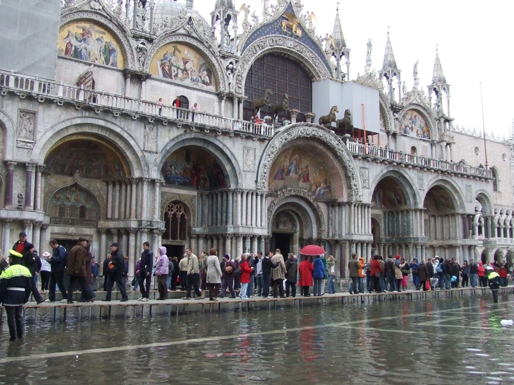
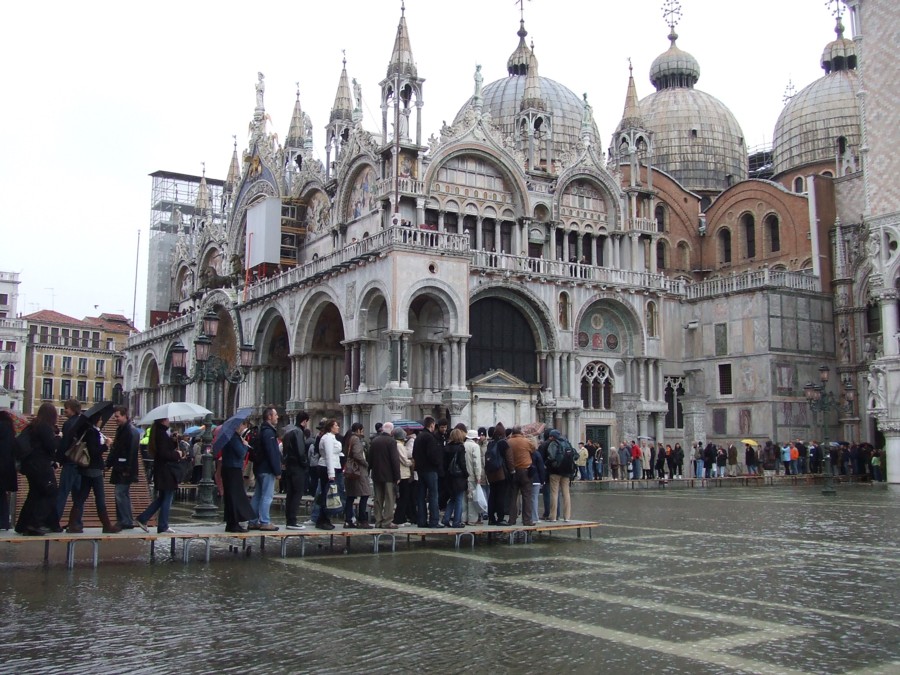
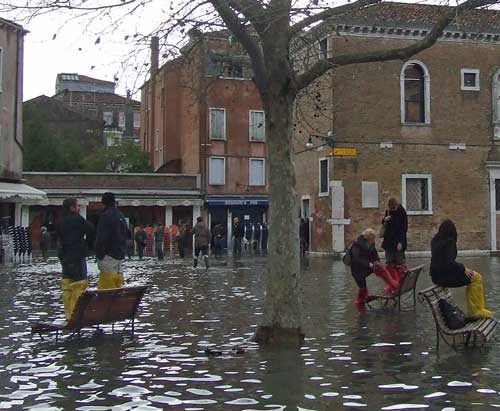
For high tides of up to 120cm, it’s still possible to get around Venice on foot. A number of temporary wooden walkways (passerelle) provide raised routes around town; maps of these are on display at vaporetto (waterbus) stops, and on the Centro Maree website (under ‘Percorsi passerelle’). Off these routes you’ll have to pick your path carefully, or decide to sit somewhere dry for an hour or two. If the floods rise above 120cm – which is still quite rare – the wooden walkways might begin to float and if the tide reaches 130cm you will find most of the city’s thoroughfares underwater. Personally, depending on where I’m heading, I’d wear wellies if the forecast is over about 105cm, and stay at home from 130cm – or buy waders.
Wellington boots are useful if you plan to march around regardless of minor floods. Tourist shops stock rubber boots and plastic shoe-covers when acqua alta is likely. Otherwise sports, hardware or fishing shops are a good bet (with boots from around 13), although these stores can be hard to find. Ask your hotel’s advice – they may have pairs you can borrow.
When there’s water everywhere it’s more important than ever to behave in an orderly fashion (see more about how to behave in Venice). High water may be fun for first-time visitors, but locals still need to get about and they won’t appreciate being splashed or obstructed. It’s not a good idea to go barefoot – the water isn’t clean and you can’t see what may lie on the pavement underneath. Dead rats are among the unpleasant detritus which rises up through flooded drains, even in the august surroundings of St. Mark’s Square. It can be hard to see where walkways end and canals begin, so proceed with care, and look for the white stones used to edge the canalsides for this reason.
The signs and the history
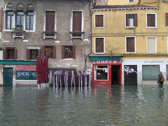
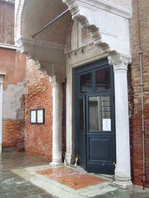
Walking around Venice you’ll see plenty of signs of the city’s propensity to flood. When the ground floor of a building is inhabited, it has usually been raised (rialzato) to lift floor levels a few inches above the level of acqua alta. You can spot the tell-tale extra step built into doorways around Venice. Many doorways also have metal or wooden guards to keep out the lapping water. There are also ongoing projects around Venice to raise the level of pavements and canalsides.
Venice’s worst flood ever was a freak event in 1966 where water levels rose to 194cm and flooded the entire city for a whole day, causing a great deal of damage, although no loss of life. In a way, that particular event had beneficial consequences for Venice, since it drew the world’s attention to the fragility of the city and resulted in the establishment of organisations determined to safeguard Venice’s artistic heritage and its future. More recently a shock high tide combined with storms on 12th November 2019 had a similar effect and left the city reeling from a tide height of 187cm combined with wind and waves. The magnitude and frequency of high tides is increasing, blamed by many on global warming, and events which were once freakish rarities are becoming more common. However, headlines around the world can give a misleading impression and all but the highest of tides would present little problems for tourists – a few hours to sit out the worst would be the mostly likely consequence. In the light of recent years, I would probably advise thinking hard about renting accommodation on the ground floor between November and March during the weeks of full or new moon, though – check at least if the floor level has been raised.
Venice’s flood problem – what has been done?
Venice has twin problems of subsidence and rising water levels. The current plan to alleviate flooding consists of giant gates (called MOSE) at the entrances to the lagoon, a project which was under way for decades and is now finally in place. Many locals maintained for years that the development was a waste of money and may worsen the situation. There have been scandals over the destination of funding, and over the long delays in finishing the project. So far MOSE has saved Venice from some high tides which would have had potentially serious impact, and it is typically put in place, at great cost, when the water is forecast to be high enough for significant inconvenience, around 110cm or higher. Wellies are needed less often, though it’s still good to check the forecast and whether or not MOSE will be activated, which is announced shortly beforehand.
Whether preventing high water is a benefit on a much wider scale might still be questioned, but Venice is certainly one of the world’s first major cities to be threatened by rising sea levels due to climate change. In the classic book about the city, Jan Morris dreams of a Venice left to its fate, with solitary belltowers protruding from the lagoon waters.
As a footnote, staying on the nearby mainland won’t necessarily guarantee you freedom from floods. Heavy rainfall (common in autumn) has been known to burst river banks and flood several of the nearby towns on the Veneto plain, where the consequences can be more serious than for Venice, which at least has an inbuilt drainage system.
Read more
> From the archives: My first-hand account – with photographs – of the floods of 1st December 2008
Useful external links
Comune di Venezia and Centro Maree – forecast & information from the Venice authorities